
FRANZ JOSEF GLACIER
12th Decembre 2022
The Franz Josef Glacier (Māori: Kā Roimata o Hine Hukatere; officially Franz Josef Glacier / Kā Roimata o Hine Hukatere) is a 12-kilometre-long (7.5 mi)[1] temperate maritime glacier in Westland Tai Poutini National Park on the West Coast of New Zealand’s South Island. Together with the Fox Glacier 20 kilometres (12 mi) to the south, and a third glacier, it descends from the Southern Alps to less than 300 metres (980 ft) above sea level.[2]
The area surrounding the two glaciers is part of Te Wahipounamu, a World Heritage Site park. The Waiho River emerges from the glacier terminal of Franz Josef.[3]
Geography

The névé or snowfield at the head of Franz Josef Glacier is over 2,500 metres (8,200 ft) above sea level and 20 square kilometres (7.7 sq mi) in area.[9] This wide névé, which is over 300 metres (980 ft) deep, feeds large amounts of compacted snow into a steep and narrow valley which drops quickly to very low altitudes: the glacier descends to 300 metres (980 ft) above sea level in just 11 km (6.8 mi). This combination of factors leads to Franz Josef persisting where most temperate-zone glaciers would have already melted, and allows it to share a valley with temperate rain forest.[10]
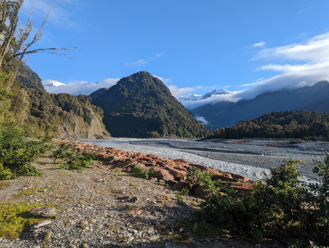
Franz Josef Glacier currently terminates 19 km (12 mi) from the Tasman Sea. Near the end of the last ice age about 18,000 years ago it extended to the present-day coastline or even beyond. As it retreated the glacier left behind moraines of accumulated rock and chunks of ice which created coastal hills and lakes. Lake Wombat is a kettle lake created by ice left in a moraine 9000 years ago, while Peters Pool close to the glacier’s face arose in the same fashion just 210 years ago.[10]
The Waiho Loop 4 km north of the settlement of Franz Josef is the terminal moraine of Franz Josef Glacier, deposited by the retreating glacier about 12,000–3,000 years ago.[10] An arc of rubble 80 m high, it was too rugged to be cleared for farming, and remains covered in native forest.[11]
Advance and retreat

Franz Josef Glacier exhibits a cyclic pattern of advance and retreat, driven by differences between the volume of meltwater at the foot of the glacier and volume of snowfall feeding the névé. Over the past 14,000 years glaciers worldwide have generally retreated. Most of New Zealand’s large glaciers shrank significantly towards the end of the 20th century, a consequence of global warming.[12] However, in the Southern Alps warmer temperatures cause increased precipitation on the western face of the Main Divide, and Franz Josef glacier being short and steep is more sensitive to increased snow in the névé than other glaciers. If the increased precipitation falls as snow, the glacier will advance; if as rain, it will retreat.[10] Increased snowfall takes around 5–6 years to result in changes in the terminus location.[9]
_%E2%80%93_the_glacier_in_2016.jpg)
Franz Josef Glacier advanced rapidly during the Little Ice Age, reaching a maximum in the early 18th century.[13] When Haast became the first European to see the glacier it was still much longer than today, and the ice surface was 300 m higher.[10] Between its first official mapping in 1893 and a century later in 1983, Franz Josef Glacier retreated 3 km up the valley.[5]

There were several periods of advance in the 20th century – 1946 to 1951 (340 m), 1965 to 1967 (400 m), 1983 to 1999 (1420 m) and 2004 to 2008 (280 m)[15] – but all were followed by periods of greater retreat.
This cyclic behaviour is well illustrated by a postage stamp issued in 1946, depicting the view from St James Anglican Church. The church was built in 1931, with a panoramic altar window to take advantage of its location. By 1954, the glacier had disappeared from view from the church, but it reappeared briefly in 1997.
Between 1983 and 2008 while most of the world’s glaciers were retreating many New Zealand glaciers advanced; Franz Josef regained nearly half the ice it had lost over the previous century. This anomalous growth has been attributed not to increased rainfall but to a series of cool years caused by increased southerly air flow in the Tasman sea.[16][17] After 2008 the glacier entered a very rapid phase of retreat, shrinking by 1.5 km between 2008 and 2017.[18][19] It is now once again 3 km shorter than it was 100 years ago.[20] Based on these patterns, Franz Josef Glacier is predicted to retreat 5 kilometres (3.1 mi) and lose 38% of its mass by 2100 in a mid-range scenario of warming,[21] although it may retreat as much as 8 kilometres (5.0 mi).[20]
Floods
There have been some incidents of jökulhlaups (outbreak floods from water-filled ice tunnels) at the glacier. The névés of Fox and Franz Josef glaciers has one of the world’s highest precipitation levels: up to 15 m a year. In December 1965, after 280 mm of rain in two days, the Waiho River broke out of the glacier and carried chunks of ice downriver. These were still up to 50 cm across when they reached the Tasman Sea 20 km downstream.[22] Another flood destroyed the access road bridge in 1989, followed by a further flood in April 1991.[9][22] Torrential rain destroyed the bridge across the Waiho River in March 2019, and it took 18 days to replace it.[23]
Flora
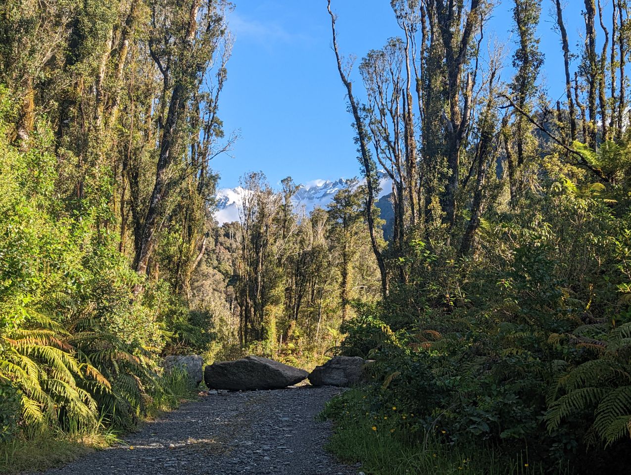
Westland Tai Poutini National Park is one of the few places in New Zealand with a full sequence of pristine landscape from mountain peaks to the sea. The retreat of Franz Josef Glacier has allowed native forest to colonise the bare rock left behind, and how long ago the glacier retreated can be read in the stage of plant succession present. Some bare rock was only exposed a decade ago, while other surfaces were exposed in 1951, 1830, 1750, and 1600.[10]